Kolsai Lakes National Park occupies 161,045 hectares across the Kungey Alatau range in southeastern Kazakhstan, protecting a chain of three alpine lakes ascending from 1,818 to 2,850 meters elevation along with the distinctive submerged forest of Lake Kaindy. Established February 7, 2007 by Government Decree No.88, the national park spans 98 kilometers east-west and 23 kilometers north-south across Raiymbek and Talgar districts of Almaty Province, with territory extending to within 30-40 kilometers of the Kyrgyzstan border. The park’s centerpiece—the Kolsai Lakes cascade—earns its reputation as the “Pearls of the Tien Shan” through pristine turquoise waters surrounded by dense Tien Shan spruce forests and alpine meadows, creating Kazakhstan’s premier multi-day trekking destination accessible from Almaty.
This guide provides comprehensive visitor and trekking information for the three Kolsai lakes, Lake Kaindy’s underwater forest, multi-day hiking routes, and practical logistics for independent travel.
Where Kolsai Lakes National Park Is Located
Geographic Position
Kolsai Lakes National Park occupies the northern slopes of the Kungey Alatau range, the easternmost extension of the Tien Shan mountain system in Kazakhstan. The park sits 280 kilometers southeast of Almaty city, with its western boundary approximately 260 kilometers from the city and eastern boundary extending to 310 kilometers.
The park’s territory straddles two administrative districts:
- Raiymbek District: 148,256 hectares (92% of park area)
- Talgar District: 12,807 hectares (8% of park area)
Proximity to International Border
The park’s southern boundary approaches the Kazakhstan-Kyrgyzstan border at distances ranging from 10-40 kilometers depending on location. This proximity influences park ecology—weather systems, wildlife populations, and hydrology connect across the international boundary creating shared ecosystem dynamics. However, standard tourist routes (Kolsai Lakes 1-3, Kaindy Lake, Saty village) remain well outside restricted border zones requiring special permits.
Mountain Context
The Kungey Alatau represents the northern face of the mountain system whose southern slopes (in Kyrgyzstan) are called Terskey Alatau. These parallel ranges flank Lake Issyk-Kul in Kyrgyzstan, with the Kungey Alatau forming the lake’s northern rim though the lake itself lies 80-100 kilometers south of Kolsai Lakes National Park territory.
Elevation within the national park ranges from approximately 1,400 meters at lowest valley floors to peaks exceeding 4,000 meters along the southern border ridge. This 2,600-meter vertical relief compresses multiple vegetation zones—steppe, forest, alpine meadow, nival—into relatively compact horizontal distance.
Access Gateway: Saty Village
Saty village (population approximately 2,000) serves as the primary gateway settlement for Kolsai Lakes National Park. Located at 1,650 meters elevation, Saty sits 12 kilometers north of Kolsai Lake 1 and provides guesthouses, basic shops, vehicle hire for Kaindy Lake access, and park entry logistics.
The village occupies a valley position where the Saty River emerges from the Kungey Alatau onto foothill terrain. Ethnic composition includes Kazakhs, Dungans (Hui Muslims from northwestern China), and Russians, with Dungan cultural influence visible in local cuisine and architecture.
Why Visit Kolsai Lakes National Park
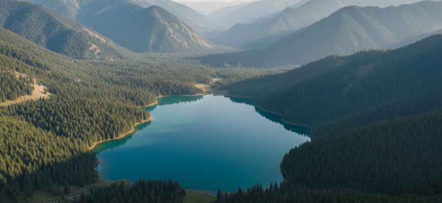
Alpine Lake Chain System
Kolsai Lakes National Park’s defining feature—three pristine alpine lakes connected by hiking trail ascending 1,032 vertical meters over 11 kilometers—creates Central Asia’s most accessible high-altitude lake trekking circuit. Each lake occupies a distinct elevation zone with corresponding landscape character:
Kolsai Lake 1 (Lower Kolsai): Forest-lake ecosystem at 1,818m; accessibility enables day visits
Kolsai Lake 2 (Middle Kolsai): Transitional subalpine environment at 2,252m; requires committed day hike or overnight approach
Kolsai Lake 3 (Upper Kolsai): High-alpine setting at 2,850m; wilderness character with minimal visitor impact
This vertical lake sequence enables progressive acclimatization while providing varied photographic subjects across distinct ecological zones.
Forest-Enclosed Valleys
Dense Tien Shan spruce (Picea schrenkiana) forests blanket valley floors and slopes between 1,600-2,600 meters elevation, creating an unusual mountain environment where trekking occurs primarily under forest canopy rather than exposed alpine terrain. This forest dominance differentiates Kolsai from many Tien Shan trekking zones where bare rocky slopes characterize the landscape.
The spruce forests support rich understory vegetation, provide wildlife habitat, and moderate temperature extremes—summer shade keeps trails 5-8°C cooler than exposed areas, while winter forest cover reduces wind chill.
Kaindy Lake’s Submerged Forest
Lake Kaindy—though separate from the Kolsai Lake chain—sits within national park boundaries 12 kilometers from Kolsai Lake 1. Created by the January 1911 magnitude 7.7-8.0 earthquake that triggered massive landslide blocking a gorge, Kaindy Lake submerged a mature spruce forest whose trunks remain standing 115 years later.
Dead tree trunks protrude 10-15 meters above the water surface, creating the region’s most photographed natural feature. Beneath the surface, preserved trunks extend down into 400-meter-long lake, visible through exceptionally clear water maintained at 4-6°C year-round.
Multi-Day Trekking Without Technical Climbing
Unlike many Tien Shan trekking objectives requiring glacier travel, high passes, or technical climbing skills, the Kolsai Lakes circuit remains accessible to fit hikers without mountaineering experience. Well-established trails, no glacier crossings, and option for camping at Middle Lake enable 2-3 day wilderness immersion within moderate difficulty parameters.
Wildlife Observation Opportunities
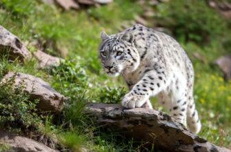
Kolsai Lakes National Park supports over 200 vertebrate species including Red Book mammals: argali (wild sheep), Tian Shan brown bear, snow leopard, Turkestan lynx, and Central Asian otter. Bird diversity exceeds 197 species including golden eagle, bearded vulture (lammergeier), saker falcon, and Himalayan vulture.
The forest-meadow ecotone at 2,400-2,600m elevation concentrates biodiversity, creating optimal wildlife observation zones along the Kolsai Lake 1-to-Lake 2 trail section.
The Three Kolsai Lakes Explained
First Kolsai Lake (Lower Kolsai, Saty Lake)
Elevation: 1,818 meters
Dimensions: Approximately 1,000 meters long, 400 meters maximum depth
Character: The largest and most accessible Kolsai lake, surrounded by dense Tien Shan spruce forest with some alpine meadow areas at the southern (upper) end. Water displays distinctive turquoise-blue color from glacial sediment, though less intense than higher-elevation Kolsai lakes due to greater sediment settling time.
Access: Paved road extends from Saty village to north shore parking area (12 kilometers, 30 minutes by vehicle). From parking, maintained trails circle portions of lake shore and provide staging for Kolsai Lake 2 ascent.
Activities:
- Shore walking and photography (1-2 hour circuit of accessible sections)
- Fishing (permit required; rainbow trout, osman species)
- Kayaking and paddleboarding (rental available summer season)
- Horseback riding (guides available in Saty village)
- Swimming (water temperature 10-14°C July-August—cold but tolerable for brief immersion)
Facilities: Visitor center near parking area; paid toilets; yurt camp accommodation with basic meals. Mobile phone coverage variable but generally functional.
Typical visitor profile: Day visitors from Almaty (via organized tour or private vehicle); families; photographers; anglers.
Optimal photography timing: Morning 7-9 AM for calm water reflections; late afternoon 5-7 PM for warm light on surrounding peaks.
Second Kolsai Lake (Middle Kolsai)
Elevation: 2,252 meters
Distance from Kolsai Lake 1: 7.2 kilometers hiking trail
Elevation gain: 596 meters from Kolsai Lake 1 (calculated: 2,252m – 1,818m = 434m; discrepancy in sources suggests 596m represents actual trail gain including undulations)
Hiking duration: 3-4 hours ascent from Kolsai Lake 1; 2-3 hours descent
Dimensions: Smaller surface area than Lower Kolsai; 50 meters maximum depth
Character: Transitional subalpine environment with spruce forest thinning to alpine meadow at lake shores. Water displays more intense turquoise color than Lower Kolsai due to higher elevation and different mineral content. The lake occupies a glacially-carved cirque with steeper surrounding slopes than Lower Kolsai.
Trail description:
- First 4 kilometers: Follows Saty River upstream through dense spruce forest with gradual, steady climb; occasional stream crossings on log bridges or stepping stones
- Kilometers 4-7.2: Steepens significantly as trail switchbacks through thinning forest; final kilometer opens to alpine meadow with views of approaching lake
- Trail condition: Well-marked and maintained; rocky in sections but no technical difficulty
Camping: Designated camping area near north shore; flat ground for 20-30 tents. No facilities—pit toilet only; campers must bring all equipment and food. Water available from lake (should be filtered/purified).
Activities: Overnight camping; day hiking base for Upper Kolsai attempt; swimming (water extremely cold, 6-10°C); photography.
Wildlife: Marmot colonies visible and audible (high-pitched warning whistles); ibex occasionally observed on surrounding slopes; birds include nutcracker, alpine accentor, various raptors.
Typical visitor profile: Fit day hikers making long round-trip from Lower Kolsai; overnight trekkers staging for Upper Kolsai; wilderness campers.
Optimal photography timing: Evening light 6-8 PM illuminates western peaks; sunrise 6-7 AM lights eastern slopes.
Third Kolsai Lake (Upper Kolsai)
Elevation: 2,850 meters
Distance from Kolsai Lake 2: 3.8 kilometers
Elevation gain: 430 meters from Kolsai Lake 2 (calculated: 2,850m – 2,252m = 598m; 430m figure from source may represent net gain excluding minor descents)
Total distance from Kolsai Lake 1: 11 kilometers; total elevation gain 1,032 meters
Hiking duration from Middle Kolsai: 2-3 hours ascent; 2 hours descent
Character: High-alpine environment above treeline; sparse vegetation limited to alpine meadow grasses, cushion plants, and ground-hugging shrubs. The lake occupies a dramatic cirque surrounded by rocky peaks and permanent snowfields. Water displays deep blue color in calm conditions; wind frequently disturbs surface due to exposed position.
Trail description:
- Condition: Poorly defined beyond Middle Kolsai; multiple braided paths created by previous hikers; cairns mark route in places but not consistently
- Terrain: Rocky with sections of loose scree; stream crossings (no bridges); alpine meadow; snowfields possible until mid-July
- Navigation: Topo map, GPS track, or experienced guide recommended; route-finding skills essential
- Physical demand: High—combination of altitude (2,600-2,850m), steep sections, and rough terrain taxes even fit hikers
Access season: July-early September only; snow covers route mid-September through June.
Facilities: None—complete wilderness.
Camping: Possible near lake shore but exposed to wind; most trekkers camp at Middle Kolsai and make Upper Kolsai a day hike.
Wildlife: Alpine specialists—ibex common on surrounding slopes; marmots at lower elevations near treeline; golden eagles and lammergeiers soaring on thermals.
Altitude effects: Significant—2,850m elevation causes noticeable breathing difficulty, rapid fatigue, and potential headache for unacclimatized visitors. Performance reduction 20-30% compared to sea level.
Typical visitor profile: Experienced mountain trekkers; photographers accepting challenging access for dramatic alpine scenery; fitness enthusiasts.
Reward-to-effort ratio: High—Upper Kolsai sees minimal visitation compared to Lower and Middle lakes, providing wilderness solitude and pristine alpine environment.
Lake Kaindy and Its Relationship to Kolsai
Formation and Geology
Lake Kaindy formed on January 3, 1911 when the magnitude 7.7-8.0 Kebin earthquake (also called Chon-Kemin earthquake) struck the northern Tien Shan, triggering catastrophic landslides throughout the region. A massive limestone and rock debris flow blocked the Kaindy River gorge, creating a natural dam 70-100 meters high.
Over subsequent months and years, rainfall and glacial meltwater accumulated behind the dam, progressively flooding the valley and submerging a mature spruce forest. The forest—estimated 200-400 years old based on tree ring analysis of exposed trunks—was inundated to depths of 20-30 meters.
Preservation mechanism: Water temperature maintaining 4-6°C year-round (even in summer) prevents decomposition bacteria from breaking down the submerged wood. This cold-water preservation keeps trunks and branches intact 115 years after submersion—an unusual longevity for non-petrified organic material.
Current Characteristics
Elevation: Approximately 2,000 meters
Dimensions: 400 meters length; maximum depth 30 meters where trunks extend below visible range
Water color: Turquoise-blue to blue-green depending on light, season, and suspended minerals
Visible trunks: 20-30 major tree trunks protrude 8-15 meters above water surface; bark stripped away leaving grey-white wood; branches fragile and breaking progressively
Underwater forest: Divers report additional trunks extending to lake bottom with branches, bark, and needles still present underwater where cold preserves them. Small fish (minnows, sculpins) inhabit the underwater forest.
Relationship to Kolsai Lakes
Geographic separation: Lake Kaindy sits in a separate drainage basin 12 kilometers west of Kolsai Lake 1. No hydrological connection exists between Kaindy and the Kolsai Lakes chain—they drain into different river systems.
Administrative unity: Both Kaindy and Kolsai Lakes fall within Kolsai Lakes National Park boundaries, established specifically to protect these distinctive water features and surrounding ecosystems.
Tourism integration: Standard 2-day Kolsai-Kaindy tours combine both destinations: Day 1 visits Kaindy Lake (requiring 4×4 access), Day 2 explores Kolsai Lake 1 or attempts Middle Kolsai. This pairing reflects proximity (both accessed from Saty village) rather than ecological connection.
Visitor appeal contrast: Kaindy attracts visitors primarily for photography of the submerged forest—a single dramatic vista. Kolsai Lakes appeal to trekkers and nature immersion seekers requiring multi-hour or multi-day commitment. These different visitor motivations create complementary rather than competing attractions.
Access to Lake Kaindy
Route from Saty village: Unpaved 4×4 track extends 12 kilometers from Saty to Kaindy Lake trailhead parking. Final 2 kilometers from parking to lake shore via hiking trail.
Vehicle requirement: High-clearance 4×4 essential; standard vehicles cannot navigate the rough track. Most visitors hire Soviet-era UAZ or similar 4×4 in Saty village (cost approximately 8,000-12,000 KZT vehicle round-trip, capacity 6-7 passengers).
Hiking duration from parking: 30-40 minutes through forest to lake shore.
Best viewing season: June-October when road passable; winter snow closes access.
Hiking in Kolsai Lakes National Park
Kolsai Lake 1 to Lake 2 Trail
Trail statistics:
- Distance: 7.2 kilometers one-way
- Elevation gain: 596 meters (from 1,818m to 2,252m)
- Ascent time: 3-4 hours at moderate pace
- Descent time: 2-3 hours
- Round-trip: 14.4 kilometers; 6-7 hours total hiking time
Trail description by section:
Section 1: Kolsai Lake 1 shore (0-1.5 km)
- Character: Level trail along lake’s western shore through dense spruce forest
- Surface: Wide, well-maintained dirt path; easy walking
- Views: Intermittent lake glimpses through trees; forest understory with ferns, mosses, flowering plants
- Elevation gain: Minimal (approximately 50-80m)
Section 2: Lower valley forest (1.5-4.5 km)
- Character: Follows Saty River upstream through mature spruce forest; steady moderate gradient
- Surface: Dirt path with exposed roots and rocks; occasional muddy sections after rain
- Stream crossings: 2-3 stream fords on stepping stones or log bridges (water volume depends on season and recent precipitation)
- Elevation gain: Approximately 250-300m over 3 kilometers
- Flora: Dense spruce canopy; understory includes wild currant, rose, honeysuckle; meadow clearings with wildflowers June-July
- Fauna: High probability of marmot sightings (audible warning whistles); nutcrackers, woodpeckers, warblers common
Section 3: Upper valley steepening (4.5-7.2 km)
- Character: Trail steepens significantly with switchbacks; forest begins thinning
- Surface: Rocky with loose stones; more demanding footing
- Elevation gain: Remaining 250-300m concentrated in final 2.7 kilometers
- Views: Forest opens progressively; glimpses of surrounding peaks; final kilometer reveals alpine meadow and approaching lake
- Final approach: Trail flattens as it reaches north shore of Kolsai Lake 2
Water availability: Saty River and tributary streams provide water throughout route; should be filtered or purified before drinking.
Trail marking: Well-defined single track; occasional red paint marks on rocks; minimal navigation challenge in clear weather.
Difficulty assessment: Moderate
- Suitable for hikers with good fitness and hill-walking experience
- Altitude (2,000-2,250m) causes noticeable breathing effort but remains manageable for most visitors
- Length and elevation gain require stamina but pose no technical obstacles
- Can be completed as long day hike (start early) or more comfortably as overnight trip camping at Lake 2
Seasonal considerations:
- June: Snow may linger in shaded sections; stream crossings higher volume from snowmelt
- July-August: Optimal conditions; full access; wildflowers at peak
- September: Autumn colors; stable weather; reduced crowds
- October: Early snow possible above 2,200m; check conditions before attempting
Kolsai Lake 2 to Lake 3 Trail
Trail statistics:
- Distance: 3.8 kilometers one-way
- Elevation gain: 430-598 meters (sources vary; 598m calculated elevation difference, 430m may represent trail profile)
- Ascent time: 2-3 hours
- Descent time: 1.5-2 hours
- Round-trip from Lake 2: 7.6 kilometers; 4-5 hours total
Trail description:
Initial section from Lake 2 (0-1 km)
- Character: Trail follows lake’s eastern or southern shore before ascending toward Upper Lake basin
- Surface: Rocky path through thinning forest transitioning to alpine meadow
- Elevation gain: Approximately 150-200m; moderate gradient
Mid-section alpine climb (1-3 km)
- Character: Above treeline; exposed alpine environment; steepening slope
- Surface: Rocky trail with sections of loose scree; minimal vegetation
- Route definition: Trail becomes less distinct with multiple braided paths; cairns present but not consistently
- Terrain challenges: Stream crossings without bridges (wet feet likely); boulder fields requiring careful footing; possible snowfields until mid-July
- Elevation gain: Approximately 200-250m
Final approach to Lake 3 (3-3.8 km)
- Character: Steep final climb into cirque containing Upper Kolsai
- Surface: Loose rock and scree; slow progress
- Elevation gain: Final 150-200m
- Arrival: Trail reaches north shore of Upper Kolsai at approximately 2,850m
Navigation: Requires map, GPS track, or guide; route-finding skills essential as trail definition poor beyond initial kilometer. Fog or clouds severely complicate navigation.
Water availability: Streams in lower section; snowmelt pools; Upper Kolsai itself.
Difficulty assessment: Challenging
- High-altitude environment (2,250-2,850m) causes significant physiological impact
- Poor trail definition requires navigation skills
- Rough terrain and elevation gain demand strong fitness
- Altitude effects (headache, fatigue, nausea possible) increase difficulty beyond physical terrain challenges
- Suitable only for experienced mountain hikers with good fitness and altitude tolerance
Seasonal considerations:
- June: Likely impassable due to snow; snowfields block route
- July: Snow clearing; early season access possible mid-to-late July
- August: Optimal conditions; snow cleared; warmer temperatures reduce altitude discomfort
- September: Good conditions early month; potential snow late September
- October onward: Winter snowpack makes route impassable
Altitude acclimatization recommendation: Spend night at Middle Kolsai before attempting Upper Kolsai; this allows physiological adjustment to 2,252m elevation, improving performance and reducing altitude sickness risk at 2,850m.
Lake 1 Shore Circuit
Trail statistics:
- Distance: 4-5 kilometers partial circuit
- Elevation change: Minimal (50-100m)
- Duration: 1.5-2 hours leisurely walking
Character: Easy shoreline trail through forest and meadow; suitable for families, casual visitors, and those not attempting higher lakes.
How to Visit Kolsai Lakes National Park
From Almaty: Transport Options
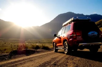
Private vehicle / rental car:
- Route: Almaty → A-3 highway east → Saty village turnoff near Zhalauly-Bazar → Saty
- Distance: 280 kilometers
- Duration: 4-5 hours (depending on traffic departing Almaty and road conditions)
- Road conditions: Paved throughout to Saty village; quality varies from good to poor with pothole sections
- Advantages: Maximum flexibility for timing, stops, exploration
- Disadvantages: Almaty traffic delays; driver fatigue on long route; parking in Saty limited
- Cost: Fuel approximately 15,000-20,000 KZT round-trip; plus rental fees if applicable
Shared taxi (marshrutka):
- Departure: Sayakhat Bus Station (Almaty)
- Frequency: 1-2 departures daily (verify current schedule locally)
- Duration: 5-6 hours including stops
- Cost: 3,000-4,500 KZT per person
- Advantages: Most economical option for solo travelers or pairs
- Disadvantages: Fixed schedule; crowded; limited luggage space; early departure times (typically 7-8 AM)
Private taxi (chartered):
- Cost: 40,000-60,000 KZT vehicle round-trip from Almaty (holds 4 passengers)
- Duration: 4-5 hours each direction
- Booking: Arrange via Yandex.Taxi app or through Almaty hotels
- Advantages: Direct service; flexible timing; door-to-door convenience
- Disadvantages: Expensive for solo travelers; cost-effective only for groups 3-4 people
Organized tour:
- Standard 2-day package: Transport, accommodation in Saty guesthouse, guided Kaindy Lake access, Kolsai Lake 1 visit, park fees
- Cost: 150-250 USD per person (price varies by group size, season, inclusions)
- Advantages: Complete logistics handled; 4×4 access to Kaindy included; guide expertise
- Disadvantages: Fixed itinerary; group pace; limited flexibility for independent exploration
Saty Village: Gateway Base
Accommodation:
- Guesthouses: 15-20 family-run guesthouses offering rooms in traditional or modern homes
- Cost: 3,000-6,000 KZT per person per night; meals additional 1,500-2,500 KZT
- Booking: Advance booking recommended July-August; walk-in possible shoulder seasons
- Amenities: Basic—shared bathrooms common; hot water availability varies; WiFi limited or absent
Services:
- Shops: 2-3 small markets selling basic provisions; limited selection—purchase main supplies in Almaty
- 4×4 hire: Soviet-era UAZ vehicles for Kaindy Lake access (8,000-12,000 KZT vehicle round-trip)
- Horse hire: Guides offer horseback trips to Kolsai lakes (negotiable pricing)
- Mobile coverage: Variable; some carriers functional, others not
Park Entrance and Fees
Kolsai Lake 1 access:
- Checkpoint: Located on road from Saty village to Kolsai Lake 1, approximately 10 kilometers from Saty
- Entry fee: Standard Kolsai Lakes National Park pedestrian entry 865 KZT per person per day (2026 rates)
- Vehicle fee: 2,595 KZT per car
- Payment: Cash only at checkpoint; no card facilities
Camping permits: If camping at Middle Kolsai, inform rangers at checkpoint; no additional fee but registration required for safety tracking.
Kaindy Lake access: Included in national park entry fee if entering via official checkpoint.
Best Time to Visit Kolsai Lakes
Spring (April-May)
Lower elevations (Kolsai Lake 1):
- Conditions: Snow melted by late April; air temperatures 8-15°C; water temperature 6-10°C
- Access: Road to Lake 1 usually clear by mid-April
- Flora: Wildflowers beginning to bloom; forest gaining spring growth
- Advantages: Few tourists; waterfalls and streams at maximum flow from snowmelt
Higher elevations (Kolsai Lakes 2-3):
- Conditions: Snow remains above 2,000m; trail to Lake 2 impassable until late May; Lake 3 inaccessible until July
- Risk: Avalanche danger on slopes above Lake 2 during snowmelt
Kaindy Lake:
- Access: 4×4 track may be impassable due to mud and lingering snow patches; verify conditions before attempting
Overall assessment: Not recommended for serious trekking; suitable only for Lake 1 day visits and village-based relaxation.
Summer (June-August)
June:
- Conditions: Trail to Lake 2 clearing of snow; Lake 3 likely still snow-covered
- Temperatures: 12-22°C at Lake 1; 8-16°C at Lake 2
- Flora: Peak wildflower bloom in meadows and alpine zones
- Advantages: Lengthening days; comfortable temperatures; lush vegetation
- Disadvantages: Stream crossings high volume (wet feet inevitable); residual snow complicates Lake 3 access
July:
- Conditions: Full trail access including Lake 3 (after mid-July)
- Temperatures: 15-25°C at Lake 1; 10-18°C at Lake 2; 8-15°C at Lake 3
- Weather: Most stable period; occasional afternoon thunderstorms
- Crowds: Increasing; weekends see maximum visitation at Lake 1
- Advantages: Optimal hiking conditions; long daylight hours (16+ hours); warm water temperatures (12-14°C at Lake 1 for swimming)
August:
- Conditions: Excellent; all trails accessible and snow-free
- Temperatures: Similar to July
- Weather: Continued stability; slightly increased afternoon storm probability
- Crowds: Peak season; Lake 1 busy, Lake 2 moderate, Lake 3 quiet
- Advantages: Warmest water temperatures; reliable weather; meadow flowers still present at high elevations
Overall assessment: Optimal season for trekking; July-August provide best combination of access, weather, and conditions.
Autumn (September-October)
September:
- Conditions: Excellent early month; weather stable; crowds diminishing
- Temperatures: Cooling—10-18°C at Lake 1; 8-14°C at Lake 2; 5-10°C at Lake 3
- Flora: Autumn colors emerging—grasses turning golden, shrubs displaying reds and yellows
- Advantages: Beautiful photography conditions; comfortable hiking temperatures; solitude
- Lake 3 access: Remains feasible early September; risk of early snow increases after mid-month
- Disadvantages: Shorter days (14 hours daylight early September, 12 hours late September); cooling temperatures require warmer clothing
October:
- Conditions: Declining; first permanent snow at high elevations
- Temperatures: 5-12°C at Lake 1; 0-8°C at Lake 2; below freezing possible at Lake 3
- Lake 3: Likely inaccessible after early October due to snow
- Lake 2: Accessible but challenging; winter gear (warm layers, gloves) necessary
- Lake 1: Remains accessible; autumn colors at peak
- Advantages: Spectacular autumn scenery; minimal tourists; dramatic light for photography
Overall assessment: September excellent for experienced hikers prioritizing scenery over crowds; October suitable only for Lake 1-2 day trips.
Winter (November-March)
Conditions: Kolsai Lakes freeze; deep snow covers trails; access road to Lake 1 often impassable.
Lake 1: Ice thickness 30-50 cm by January; locals occasionally drive vehicles on frozen lake surface.
Kolsai Lakes 2-3: Completely inaccessible; buried under snowpack.
Saty village: Remains inhabited year-round but tourism infrastructure largely closed; guesthouses limited.
Winter activities: Ice fishing on Kolsai Lake 1 (locals only; specialized equipment required); winter hiking at low elevations (snowshoes necessary); photography of frozen landscapes.
Overall assessment: Not recommended for tourists; specialized winter mountaineering experience required for any activities beyond village vicinity.
Accommodation in Kolsai Area
Guesthouses in Saty Village
Typical characteristics:
- Family-run establishments in private homes
- Rooms sleep 2-4 guests; shared bathrooms common
- Bedding and towels provided
- Hot water availability varies (some solar-heated, some wood-fired, some limited hours)
- WiFi generally absent or unreliable
Meal options:
- Most guesthouses offer traditional meals (Kazakh, Dungan, Russian cuisine) by arrangement
- Breakfast: 800-1,200 KZT (bread, eggs, porridge, tea, jam)
- Dinner: 1,500-2,500 KZT (lagman, plov, beshbarmak, salad, tea)
- Packed lunch: 800-1,200 KZT (sandwiches, fruit, snacks, water)
Booking: Contact via phone (numbers available through Almaty tour agencies) or arrange through tour operators. July-August advance booking essential; other months walk-in possible.
Cost range: 3,000-6,000 KZT per person per night.
Camping at Kolsai Lake 1
Location: Designated camping area near north shore parking.
Facilities: Basic pit toilets; no running water (use lake water with filtration); no other services.
Cost: Typically included in park entry fee; verify current policy at checkpoint.
Advantages: Immediate lake access; sunrise/sunset photography opportunities; lower cost than guesthouses.
Disadvantages: Must carry all camping equipment; exposed to weather; limited security for gear left in tents.
Camping at Kolsai Lake 2 (Middle Kolsai)
Location: Designated area near north shore; flat ground for approximately 20-30 tents.
Facilities: Pit toilet only; no other infrastructure.
Water: Lake water (must filter/purify); small streams entering lake.
Cost: Included in park entry; inform rangers at entrance checkpoint for safety registration.
Requirements:
- Bring complete camping equipment (tent, sleeping bag rated 0°C or colder, sleeping pad, stove, cookware, food)
- Pack out all waste
- No fires; use backpacking stove only
Advantages: Enables multi-day exploration; staging for Upper Kolsai attempt; wilderness immersion; altitude acclimatization.
Weather considerations: Temperature drops to 0-5°C overnight even July-August; rain and wind possible; prepare for cold conditions.
Yurt Camps
Location: Near Kolsai Lake 1 parking area.
Structure: Traditional felt-covered yurts sleeping 4-8 guests on floor mattresses.
Amenities: More comfortable than camping; communal meals provided; basic toilet facilities.
Cost: 5,000-8,000 KZT per person per night including meals.
Booking: Arrange through Saty guesthouses or Almaty tour operators.
Season: Operate June-September only.
Multi-Day Trekking Routes
2-Day Kolsai Lakes Trek
Day 1: Almaty to Saty to Kolsai Lake 2
- Depart Almaty 6-7 AM (4-5 hour drive)
- Arrive Saty 11 AM-12 PM; lunch at guesthouse or packed
- Drive to Kolsai Lake 1 parking (30 minutes, 12 km)
- Begin hike to Kolsai Lake 2: 1-2 PM departure
- Ascend 7.2 km, gaining 596m elevation (3-4 hours)
- Arrive Middle Kolsai 5-6 PM
- Set up camp; prepare dinner; evening at lake
- Overnight: Camping at Kolsai Lake 2 (2,252m)
- Total hiking: 7.2 km, +596m elevation, 3-4 hours
- Camping gear: Required
Day 2: Kolsai Lake 2 to Lake 1, return to Almaty
- 6-7 AM: Wake, breakfast
- 8 AM: Break camp, begin descent to Kolsai Lake 1
- 10:30 AM: Arrive Lake 1 (2-3 hours descent)
- 11 AM-12 PM: Rest at Lake 1; lunch
- 12:30 PM: Depart for Saty village
- 1-2 PM: Optional stop in Saty for late lunch
- 2-3 PM: Begin drive to Almaty (4-5 hours)
- 7-8 PM: Arrive Almaty
- Total hiking: 7.2 km, -596m elevation, 2-3 hours
- Alternative: Extend with Kaindy Lake visit morning Day 2 before returning (adds 3-4 hours)
Difficulty: Moderate to challenging; requires good fitness and basic backpacking experience.
3-Day Kolsai Three Lakes Complete Circuit
Day 1: Almaty to Kolsai Lake 2 (identical to 2-day itinerary Day 1)
- Almaty → Saty → Lake 1 → hike to Lake 2
- Camp at Middle Kolsai
- Hiking: 7.2 km, +596m, 3-4 hours
Day 2: Kolsai Lake 2 base; Upper Kolsai summit attempt
- Light day pack (leave camp set up at Lake 2)
- 7-8 AM: Depart camp for Upper Kolsai
- 10-11 AM: Arrive Upper Kolsai (2,850m) after 2-3 hour ascent
- 11 AM-1 PM: Explore Upper Lake; lunch; photography
- 1-2 PM: Begin descent to Middle Kolsai
- 3-4 PM: Return to camp at Lake 2
- Evening: Rest, dinner, sunset at Middle Kolsai
- Overnight: Camping at Kolsai Lake 2
- Hiking: 7.6 km round-trip, +598m/-598m elevation, 4-5 hours total
- Note: Altitude effects significant at 2,850m; headache, nausea possible
Day 3: Kolsai Lake 2 to Lake 1, Kaindy Lake, return Almaty
- 7 AM: Break camp, descend to Lake 1 (2-3 hours)
- 10 AM: Arrive Lake 1; meet 4×4 vehicle
- 10:30 AM: Drive to Kaindy Lake trailhead (30-40 minutes rough road)
- 11:30 AM: Hike to Kaindy Lake (30-40 minutes)
- 12 PM-2 PM: Kaindy Lake exploration; lunch; photography
- 2:30 PM: Return to Saty village
- 3:30-4 PM: Depart for Almaty
- 8-9 PM: Arrive Almaty
- Hiking: 7.2 km + 4 km (Kaindy), -596m elevation Lake descent
- 4×4 cost: ~10,000 KZT vehicle (split among group)
Difficulty: Challenging; requires strong fitness, altitude tolerance, backpacking experience, and wilderness camping skills.
Advantages over 2-day: Complete three-lake experience; acclimatization at Lake 2 improves Lake 3 attempt; full Kolsai-Kaindy region coverage.
Alternative 3-Day: Relaxed Pace with Kaindy
Day 1: Almaty to Saty; Kaindy Lake afternoon
- Morning drive to Saty (arrive 11 AM-12 PM)
- Check into guesthouse; lunch
- Afternoon 4×4 to Kaindy Lake (3-4 hours round-trip including hiking)
- Evening return to Saty; dinner at guesthouse
- Overnight: Saty guesthouse
- Hiking: 4 km round-trip, minimal elevation
Day 2: Kolsai Lake 1 to Lake 2 day hike
- 8 AM: Depart Saty for Lake 1 (30 min drive)
- 9 AM: Begin ascent to Lake 2
- 12-1 PM: Arrive Lake 2; lunch
- 1-3 PM: Explore Middle Kolsai
- 3 PM: Begin descent
- 5-6 PM: Return to Lake 1; drive to Saty
- Evening at guesthouse
- Overnight: Saty guesthouse
- Hiking: 14.4 km round-trip, +596m/-596m, 6-7 hours
Day 3: Kolsai Lake 1 relaxed visit; return Almaty
- Morning drive to Lake 1
- Short shore hikes; swimming if warm enough; photography
- Midday depart for Almaty (4-5 hours)
- Late afternoon arrival Almaty
- Hiking: 4-5 km easy shore walking
Difficulty: Moderate; no camping required; comfortable guesthouse accommodation; but Day 2 remains long hike.
Advantages: No camping gear needed; guesthouse meals and comfort; more accessible for those without backpacking equipment.
Combining Kolsai, Kaindy & Charyn Canyon
3-Day Regional Circuit
Day 1: Almaty → Charyn Canyon → Saty
- 6-7 AM: Depart Almaty for Charyn Canyon (200 km, 3 hours)
- 10 AM-1 PM: Charyn Valley of Castles exploration (2-3 hour hike)
- 1-2 PM: Lunch at canyon
- 2 PM: Depart Charyn for Saty village (120 km, 2 hours)
- 4 PM: Arrive Saty; check into guesthouse
- Evening: Rest in village
- Overnight: Saty guesthouse
- Total driving: 320 km, 5 hours
- Hiking: 4 km canyon circuit
Day 2: Kaindy Lake + Kolsai Lake 1
- Morning: 4×4 to Kaindy Lake; 3-4 hours total including hiking
- Midday: Return to Saty for lunch
- Afternoon: Drive to Kolsai Lake 1; shore walking and photography (2-3 hours)
- Evening: Return Saty guesthouse
- Overnight: Saty guesthouse
- Hiking: 4 km Kaindy + 4-5 km Kolsai Lake 1 shore
Day 3: Kolsai Lake 2 day hike; return Almaty
- Early departure for ambitious Lake 2 round-trip (7-8 hours hiking)
- OR relaxed Lake 1 morning, early afternoon departure for Almaty
- 280 km, 4-5 hours drive back to Almaty
- Evening arrival Almaty
- Hiking options: Either 14.4 km Lake 2 round-trip OR easy Lake 1 walking
Terrain covered: Canyon erosion geology, submerged forest, alpine lakes, Tien Shan spruce forests.
5-Day Comprehensive Circuit
Days 1-3: Follow 3-day circuit above
Day 4: Kolsai Three Lakes overnight
- Hike to Middle Kolsai with camping gear (7.2 km, 3-4 hours)
- Set up camp; afternoon relaxation
- Overnight camping at Lake 2
- Hiking: 7.2 km, +596m
Day 5: Upper Kolsai attempt; return to Almaty
- Morning: Upper Kolsai round-trip from Lake 2 camp (7.6 km, 4-5 hours)
- Midday: Break camp, descend to Lake 1 (7.2 km, 2-3 hours)
- Afternoon: Drive to Almaty (280 km, 4-5 hours)
- Evening: Arrive Almaty
- Hiking: 14.8 km total; +598m/-1,194m elevation
Advantages: Complete regional coverage; manageable daily distances; altitude acclimatization at Lake 2 before Upper attempt.
Practical Visitor Tips
Permits and Border Zones
National park entry: Standard entry fee 865 KZT per person covers all Kolsai Lakes and Kaindy Lake access. Purchase at checkpoint on road to Kolsai Lake 1.
Border zone considerations: Kolsai Lakes National Park extends to within 10-40 km of Kyrgyzstan border. Standard tourist routes (Saty village, Kolsai Lakes 1-3, Kaindy Lake) remain outside restricted border zones—no special permit required.
Off-trail exploration: Hikers planning routes beyond established trails approaching southern park boundaries should verify with park rangers whether border zone permits required. Processing time 14-30 days if needed.
Weather and Climate
General patterns:
- Summer (June-August): Stable weather; daytime 15-25°C at 1,800m, 8-15°C at 2,850m; occasional afternoon thunderstorms
- Autumn (September-October): Cooling temperatures; increasing precipitation; early snow at high elevations
- Winter (November-March): Heavy snowpack; temperatures -10 to -20°C; most areas inaccessible
- Spring (April-May): Variable conditions; rapid weather changes; snowmelt creating high water volumes
Microclimates: Valley bottoms (Lake 1) significantly warmer than high elevations (Lake 3); temperature drops approximately 6-7°C per 1,000m elevation gain.
Precipitation: Annual average 600-800mm, concentrated spring and early summer; dry period July-August; autumn rains September-October.
Weather hazards: Afternoon thunderstorms July-August bring lightning risk at high elevations; rapid temperature drops with storm passage; hail possible; wind increases above treeline.
Altitude Considerations
Elevation profile:
- Saty village: 1,650m
- Kolsai Lake 1: 1,818m
- Kolsai Lake 2: 2,252m (altitude effects begin for sea-level residents)
- Kolsai Lake 3: 2,850m (significant altitude effects)
Physiological impacts:
- Below 2,000m: Minimal effects for most visitors
- 2,000-2,500m: Increased breathing effort during exertion; mild fatigue
- 2,500-3,000m: Noticeable performance reduction (20-30%); headache possible; nausea in susceptible individuals
Acclimatization strategy:
- Spend first night in Saty village (1,650m) rather than immediately ascending
- Day 1: Hike to Lake 1 only (1,818m)
- Day 2: Attempt Lake 2 after acclimatization sleep at lower elevation
- For Lake 3: Sleep at Lake 2 (2,252m) before attempting 2,850m
Acute Mountain Sickness prevention: Increase hydration 50%; avoid alcohol 24 hours before high-altitude days; ascend gradually; recognize symptoms (persistent headache, nausea, dizziness) and descend if severe.
Essential Gear
Day hiking (Lake 1 or Lake 1-to-2 day trip):
- Sturdy hiking boots with ankle support
- Layered clothing (base layer, insulating mid-layer, waterproof shell)
- Sun protection (hat, sunglasses, SPF 50+ sunscreen)
- 2-3 liters water capacity per person
- Snacks and lunch
- First aid kit, whistle, headlamp
- Map and GPS device or smartphone with downloaded offline maps
- Rain jacket and warm layer (even summer—weather changes rapidly)
Overnight camping (Lake 2):
- All day hiking gear plus:
- 3-season tent (capable of handling wind and rain)
- Sleeping bag rated 0°C or colder (temperatures drop to 0-5°C overnight even summer)
- Sleeping pad (insulation from cold ground essential)
- Backpacking stove and fuel
- Cookware, utensils, food for all meals
- Water filter or purification tablets
- 50-60 liter backpack (adequate for gear plus 2 days food and water)
- Trekking poles (aid descent with heavy pack)
Upper Kolsai attempt:
- Lightweight day pack for Lake 2-to-3 (leave camping gear at Lake 2)
- Extra warm layers (fleece + insulated jacket)
- More snacks (altitude increases calorie needs)
- Emergency shelter (lightweight bivy or emergency blanket)
Food and Water
Water sources: Kolsai Lakes, Saty River, tributary streams provide abundant water throughout park. All natural water must be filtered or purified before drinking—giardia and other waterborne pathogens present.
Water treatment options: Portable filter, UV sterilizer, or purification tablets.
Food strategy:
- Day hikes: Bring all food from Saty village or Almaty; nothing available at trailheads
- Multi-day camping: Purchase supplies in Almaty (best selection) or Saty (basic only)
- Calorie needs: Increase intake 30-40% above normal due to hiking exertion and altitude
- Pack-out requirement: All food waste, packaging, and trash must be carried out
Safety and Emergency
Rescue services: Limited rescue capability in park; helicopter